The Great Westside Short-Cut Hunt : Traffic: Ever since the quake collapsed part of the Santa Monica Freeway, people have found new ways to get to work--and somehow managed to avoid gridlock.
- Share via
Psst! Wanna buy a short-cut?
Sorry, there aren’t any.
But there are ways to avoid the traffic nightmare surrounding the site where the Santa Monica Freeway fell down, and Westside drivers are finding them.
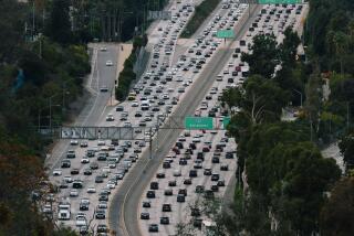
Traffic since the Jan. 17 earthquake has almost doubled on some boulevards, quiet side streets teem at rush hour, and highways as far away as the Ventura Freeway and the newly-built I-105 are taking on extra drivers who once sped--or crawled--along Interstate 10’s elevated roadway.
But despite frayed tempers and delays, gridlock has been kept at bay.
“Listen up. How many horns have you heard?” asked Max Paetzold, a city transportation engineer stationed near the freeway collapse site at rush hour one afternoon last week.
Cars were lined up for hundreds of yards in every direction, but there was little honking at the spot, where huge sandbagged tarps--workers call them “Saran Wrap”--cover the stub ends of the severed freeway.
“Basically, Angelenos have a sense of survival,” Paetzold said.
Engineers list several reasons why the system is muddling through, at least for now:
* Staggered work hours.
* Increased use of car pools and bus service.
* Shortened detours across the freeway’s missing link between Fairfax Avenue and La Cienega Boulevard.
* Computerized traffic signals that have been adjusted to allow greater flows of east-west traffic on surface streets.
* Just plain flexibility on the part of drivers.
“There never is one single magic pill,” said Tom Conner, assistant general manager of the Los Angeles City Department of Transportation. “It’s a combination of factors that solves the problem.”
Before the quake, Conner said, traffic along that shaky stretch of the Santa Monica Freeway averaged about 271,000 trips a day. With the freeway cut, the equivalent of 20 lanes of extra traffic was dumped onto city streets.
The impact was drastic. In the days after the catastrophe, traffic along Jefferson Boulevard more than doubled. It increased by as much as 90% on Adams Boulevard and 80% on Pico Boulevard.
With Fairfax Avenue closed, along with La Cienega Boulevard, Venice Boulevard and Washington Boulevard, north-south traffic was also thrown into disarray. La Brea Avenue, which was already near capacity, showed a 13% increase in traffic, and similar delays were reported as far west as Lincoln Boulevard.
Since then, things have eased a bit with the reopening of Fairfax, Washington and Venice, Conner said.
He also put in a plug for a new freeway bus line, based at an 800-space parking lot at the West Los Angeles Veterans Center and offering service to downtown Los Angeles at $1.50 each way.
But it’s too early to say that happy times are on the horizon.
“A lot of people who made discretionary trips before the earthquake are not back making those trips, but we know (the demand) is out there,” Conner said. “Traffic will build up.”
Though what’s left of the freeway is running at about a third of pre-quake capacity, some drivers have struck out to find their own way through residential side streets.
No one knows exactly how many of these adventurers there are. But David J. Rizzo, a part-time podiatrist who advises motorists as a Los Angeles radio station’s “Dr. Roadmap,” cited a study showing that 52% of drivers never change their customary route.
“In this case what they’re doing is following the Caltrans detours,” Rizzo said, “but I guarantee you, if one street gets too crowded, (other) people will start to look elsewhere.”
Author of a guidebook that angered residents whose surface streets he recommended as freeway alternates, Rizzo suggested a nifty way for making one’s way inland from the ocean.
Starting with an eastbound jaunt down Olympic Boulevard, he said, a canny driver might swing south at Manning Avenue to National Boulevard, then zig down Robertson Boulevard to Higuera Street, which leads to Rodeo Road and a straight shot to the USC area.
Among his other favorites are Ohio Avenue, Sawtelle Boulevard and Braddock Drive, which parallels Culver Boulevard in a northeast-southwest direction.
“It’s a residential street and people are going to complain, but it’s wonderful,” Rizzo said.
One driver who has changed her ways since the quake is Carol G. Miller, an attorney and Santa Monica resident. She has taken to car-pooling.
“I come in more relaxed, there’s less wear and tear on the car and I’ve got a chance to get caught up with friends, which we didn’t have the opportunity to do before,” said Miller, a research attorney at the state Court of Appeal.
“(The commute) is getting to be a lot faster than it was before the quake,” she said.
But there is a price. To pick up her two fellow riders and get downtown before the worst of the morning traffic, Miller finds herself leaving home at 7 a.m., an hour before her usual departure time, and staying later in the evening.
Her car pool takes surface streets to get around the gap between La Cienega and Fairfax, she said.
But a Caltrans official said that car pools and buses have been clocked going three times as fast on the freeway, even with its detours, as on surface streets.
Despite delays of no more than six minutes, bus-and-car pool lanes are running about half empty, said Chuck O’Connell, deputy district director of operations for traffic.
“I suspect people are shying away from the Santa Monica Freeway because of the detours, and quite frankly, if they swarmed back on they’d create some hellacious queues,” he said.
“But we expect them to increase as more people find out about it,” he said. “Drivers are selecting the routes that meet their needs. It’s like water. It tends to find its own level.”
Car Wars
Since the collapse of the Santa Monica Freeway on Jan. 17, traffic has swelled on east-west surface streets near the freeway. Average daily traffic counts at two locations on Pico Boulevard tell the story:
PICO AT: BEFORE JAN. AFTER JAN. CHANGE Robertson Blvd. 32,918 55,588 +69% Sepulveda Blvd. 36,523 51,023 +40%
Source: Los Angeles Department of Transportation
More to Read
Sign up for Essential California
The most important California stories and recommendations in your inbox every morning.
You may occasionally receive promotional content from the Los Angeles Times.


