Low pressure could bring much-needed rain to California before mid-March

- Share via
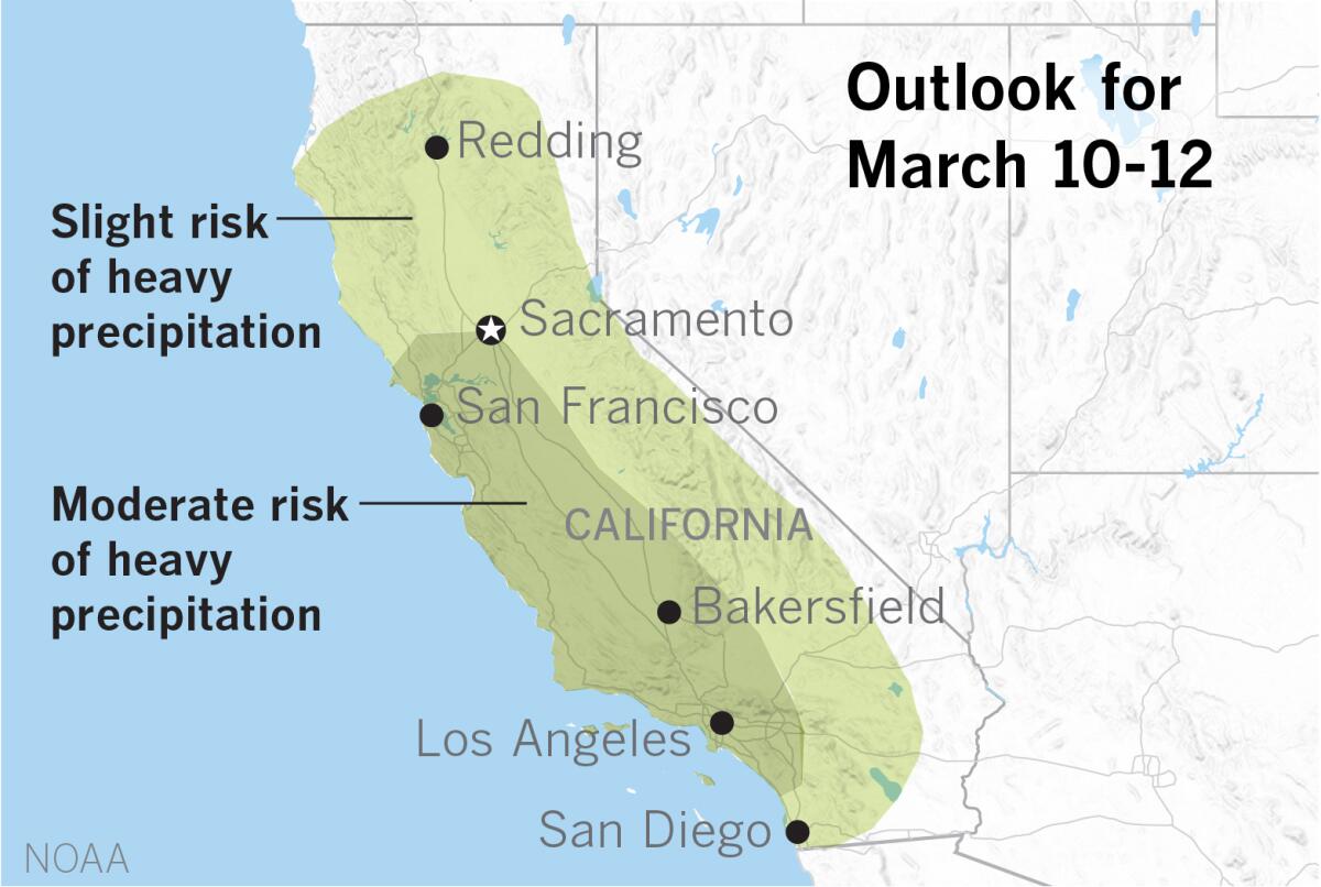
An upper-level trough over the eastern Pacific is forecast to come ashore and bring much-needed moisture to California from Tuesday, March 10, through Thursday, March 12, according to an outlook issued by the National Weather Service’s Climate Prediction Center.
The weather system is expected to create a moderate risk for heavy precipitation over an area from north of San Francisco to around San Diego County. The area stretches inland to Sacramento on the north and to the foothills east of Bakersfield in the south. A wider area covering much of the remainder of the state, reaching from north of Redding, east nearly to the Nevada border and south to the Mojave Desert and the Mexican border, is considered to be at a slight risk of heavy precipitation during the same period. Rain is expected at lower elevations while the precipitation will fall as snow in the Sierra Nevada and other higher elevations.
Much of the area where precipitation is predicted is either abnormally dry or considered to be in moderate drought, according to the most recent Drought Monitor data released Thursday.
Parts of California are experiencing abnormal dryness and short-term drought, so this additional forecast rainfall could help stall any worsening conditions, the weather service said.
More to Read
Sign up for Essential California
The most important California stories and recommendations in your inbox every morning.
You may occasionally receive promotional content from the Los Angeles Times.


