Timeline: When will California storms hit hardest and how long will they last?

- Share via
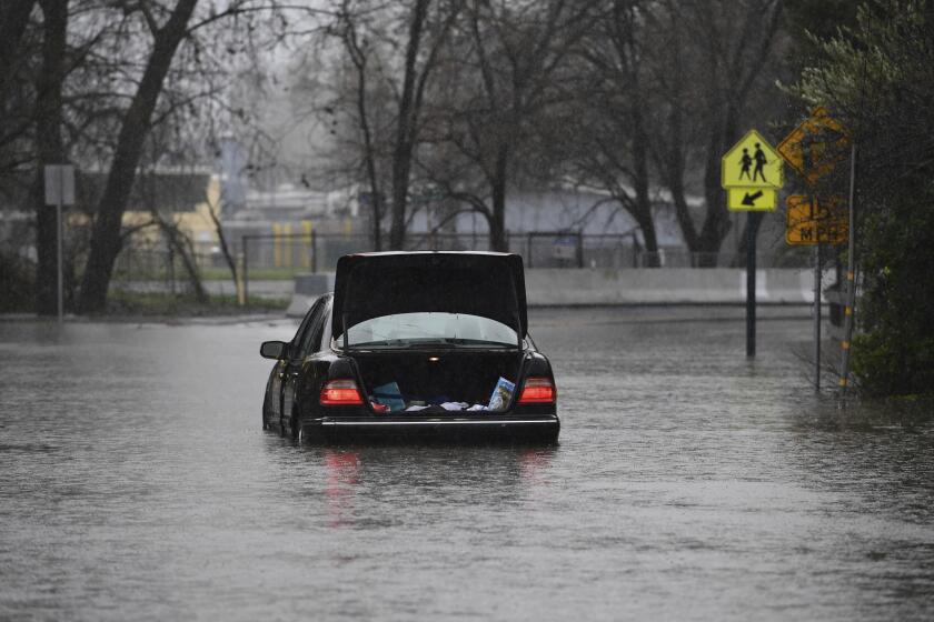
Here is what to expect from the atmospheric river storm barreling into California on Wednesday and continuing Thursday. Officials are warning of potential flooding as well as damaging winds.
Southern California forecast
Wednesday: Rains begin. Snow levels drop to 6,500 feet. Damaging south winds. Storms will be stronger in northern parts of region than in southern parts.
Thursday: The main band of the storm moves in, with more intense showers. Thunderstorms. Rain totals for the storm: 2 to 4 inches in some parts of metro areas, 4 to 8 inches in some mountain areas. Forecasters predicted rush hour Thursday morning could become a nightmare, with minor flooding, the potential for fallen trees and other debris on the road and possible power outages.
Friday: Rain ends. But high surf should continue being a flood concern.
Days of significant rainfall have already soaked much of the state. A flood watch has been issued for much of Northern California.
Beyond: “As we get into Sunday and early next week, there’s still potential for some wet events, just not as strong as what we’re expecting Wednesday and Thursday,” said Eric Boldt, a National Weather Service meteorologist. “We’ll continue to see rainfall going into next week.”
Analysis: Rich Thompson, a National Weather Service meteorologist in Oxnard, said rains will become heavier through Thursday. Parts of Los Angeles and Ventura counties are under a flood watch beginning Wednesday evening, while areas of Orange, Riverside and San Bernardino counties have a flood watch issued for Thursday.
Northern California
Wednesday: Intense rains begin, hitting particularly hard in the afternoon and evening. “The Wednesday night storm at least is definitely one that could produce new mudflows or exacerbate existing ones,” UCLA climate expert Daniel Swain said. “For tomorrow night, that might be a good night to be vigilant or activate whatever plans you have for storms like that, if you live in that kind of terrain.” The heaviest rainfall is likely to be focused in the north and central coastal ranges and the Sierra foothills north of the Bay Area, he said.
Thursday: Rains continue before tapering off. Damaging winds remain a concern. River flooding also possible in some areas.
Beyond: More storms are expected next week.
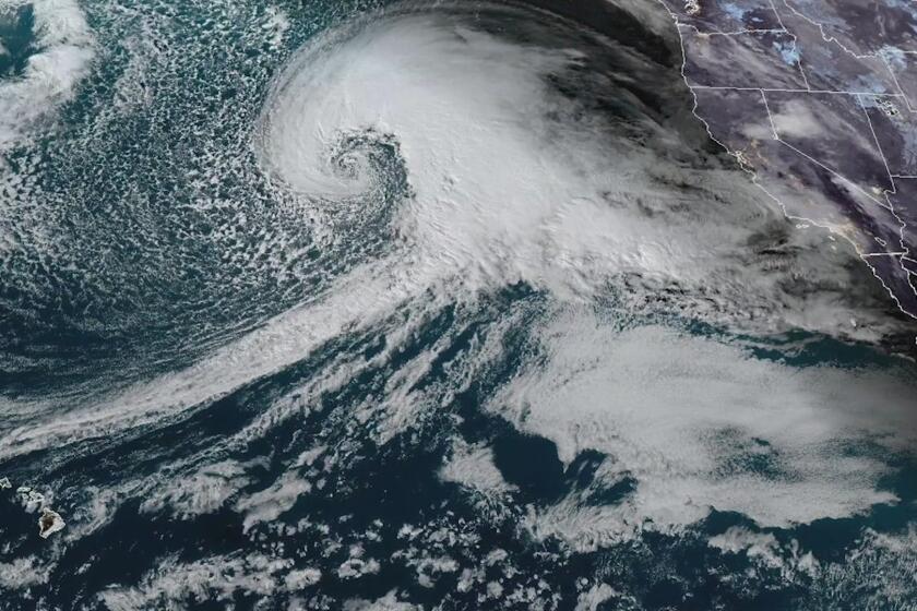
The atmospheric rivers set to arrive in California are being fed in part by a storm system sitting several hundred miles off the northern Pacific coast.
Analysis: “We already have some ongoing flooding in the area ... and we’re expecting more heavy rain,” said Scott Rowe, a meteorologist with the National Weather Service in Sacramento. The Sacramento Valley can expect 2 to 3 inches of rain from Wednesday through Friday, while some areas in the foothills could see up to 6 inches — on top of the multiple inches from days prior, he said. San Franciscans can expect to see at least 2 more inches of rain from the midweek storm.
The storm
The atmospheric rivers set to arrive in California are being fed in part by a storm system sitting several hundred miles off the northern Pacific coast.
Meteorologists are already referring to the system as a “bomb cyclone” as it builds in intensity. “Bombogenesis” occurs when the system’s barometric pressure rapidly drops over a 24-hour period, generating a vacuum-like effect that funnels the storm and causes it to generate strong winds. In essence, the atmospheric rivers set to arrive will be accompanied by the bomb cyclone storm system.
“The atmospheric river event is able to tap into the moisture over the Pacific and bring in higher moisture to California,” said Cory Mueller, a meteorologist with the National Weather Service in Sacramento.
When the stream hits California’s mountainous coasts, the atmospheric river pushes to higher altitudes to continue moving east. This tends to cool and condense the moisture in the tropical storm front, which then leads to rainfall.
Tips
- How to drive in the rain
- Checking your flood risk
- How to stay safe during the big storm
- How to prepare for mudslides and debris flows
- How a mudslide happens
More to Read
Sign up for Essential California
The most important California stories and recommendations in your inbox every morning.
You may occasionally receive promotional content from the Los Angeles Times.


