Was Hurricane Hilary overhyped? It wasn’t unprecedented, but warnings likely saved lives
- Share via
As Hurricane Hilary barreled toward Southern California last week, the storm made international news as forecasters warned of the possibility for life-threatening and catastrophic flooding from heavy rains, especially in the mountains and deserts.
Officials issued the region’s first-ever tropical storm watch — later upgraded to a warning — for a broad swath of the Southland as the cyclone’s path grew more clear, likely to become the first storm of that strength to hit the region in decades.
And although the system turned out to be historic for Southern California — dumping record summer rainfall and hitting tropical storm wind speeds recorded only twice in the last century — weather officials say the situation was not unheard-of for the region. While some areas experienced flooding, damage was limited and there were no reports of deaths associated with the storm in California.
“We had been actively planning for and practicing for a scenario such as Hilary,” said Jamie Rhome, deputy director of the National Hurricane Center. “Scientifically, it wasn’t beyond the realm of understanding or that atypical. It’s rare, it doesn’t happen all the time, but it certainly has happened enough times in the past that we knew it could happen again.”
He called Hilary’s path and strength “unusual, but not unprecedented.”
The last tropical storm to move across California was Nora in 1997, which tracked over the state’s southeastern border with Arizona before quickly weakening into a tropical depression, according to the National Hurricane Center. It brought heavy rains and minor flooding across much of Southern California — even damaging waves on the Orange County coast — but the most significant flood damage hit farmers in the Imperial Valley, according to The Times’ archives.
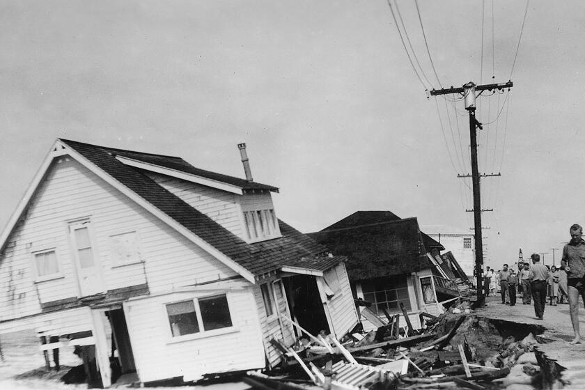
Long before Hurricane Hilary, ‘El Cordonazo’ or ‘the Lash of St. Francis’ devastated Long Beach and San Pedro in September 1939.
The other tropical storm that hit the region in recent history — which traveled directly over the Los Angeles Basin, as Hilary did — was an unnamed system that made landfall around San Pedro in 1939, dumping more than 5 inches of rain on L.A. in 24 hours and leaving dozens dead, according to a National Weather Service document. The storm became known as “El Cordonazo,” or “The Lash of St. Francis,” records show. In the aftermath of that storm, federal officials created their first forecast office in Southern California, noting that residents had been “generally unprepared” for the tropical storm, the archived document said.
And therein may lie perhaps the biggest difference between Hilary and the other two tropical storms that most recently hit Southern California: The National Weather Service had recently bolstered its operations and alert systems for this exact situation. Hilary becoming the first West Coast storm to get an official tropical storm warning — which officials have credited for increasing awareness and minimizing harm — didn’t necessarily mean Hilary was a stronger, wetter or more dangerous system. The storm just happened to come right after local forecast offices gained the capability to issue such a warning.
“Just in time,” said Philip Gonsalves, a National Weather Service meteorologist in San Diego. “It required training of personnel, it required adding software to our computers and establishing protocols with the National Hurricane Center.”
In July, the National Weather Service offices in San Diego and Oxnard, which provide forecasts for the majority of Southern California, completed a “years-long process” to enhance tropical storm response, he said.
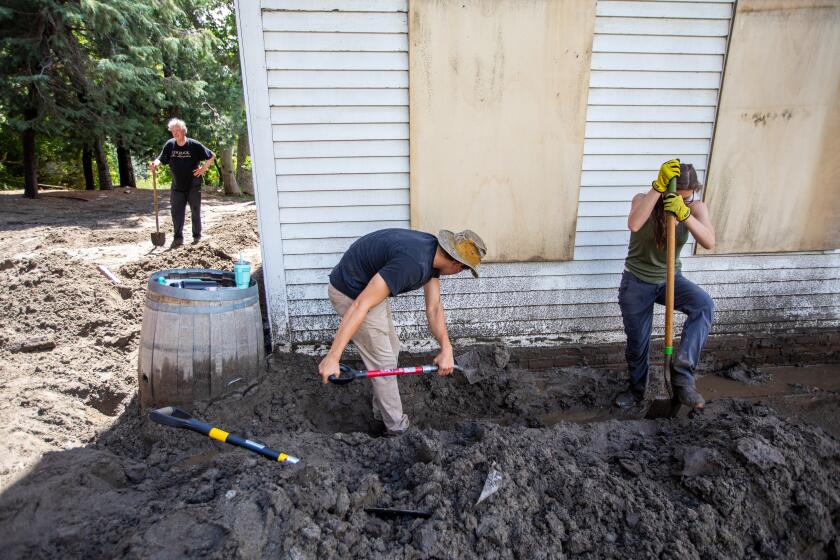
‘I think I’ll be able to get out today’: Residents trapped by Tropical Storm Hilary begin to dig out
Rescue teams are still working to get to some residents of hard-hit San Bernardino mountain communities after Hilary. A woman remains missing in the Seven Oaks area.
Previously, forecasters may have just issued high wind and flash flood warnings, said National Weather Service meteorologist Rose Schoenfeld, but the newly implemented system — which forecasters already employ along the Gulf and East coasts — could better alert and prepare Californians, who are overwhelmingly inexperienced at dealing with tropical storms.
“We had been actively working in this area to prepare for and enhance our messaging and our products to be as prepared as we could be when something like this unfolds,” Rhome said. He said it’s still too early to determine with certainty the success of the system’s first activation, but initially he thought it went well, noting that forecasts, especially for rainfall, were pretty accurate.
“The ‘stay at home, stay informed and stay safe’ messaging played a major role in reducing exposure to potential dangers,” Los Angeles Fire Capt. Erik Scott said. “We were fortunate because first responders and Angelenos were prepared, heeded warnings, and the weather was less severe than expected.”
And the conditions that came with Hilary were not entirely extraordinary for Southern California. Forecasters said the region has seen — albeit not regularly — this kind of heavy rain and flooding from other tropical systems, even without an official tropical storm making landfall.
“You don’t have to have the tropical systems move right up into California or Arizona,” said Paul Iñiguez, a forecast verification analyst for the Center for Western Weather and Water Extremes at UC San Diego’s Scripps Institution of Oceanography. “Storms that are hundreds of miles away can have a big impact.”
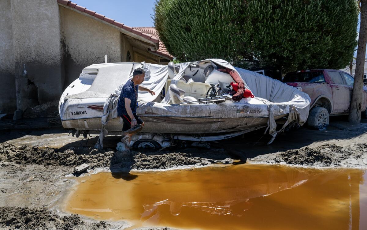
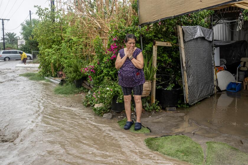
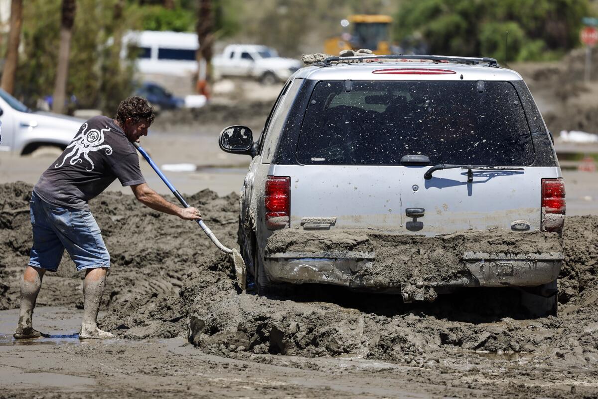
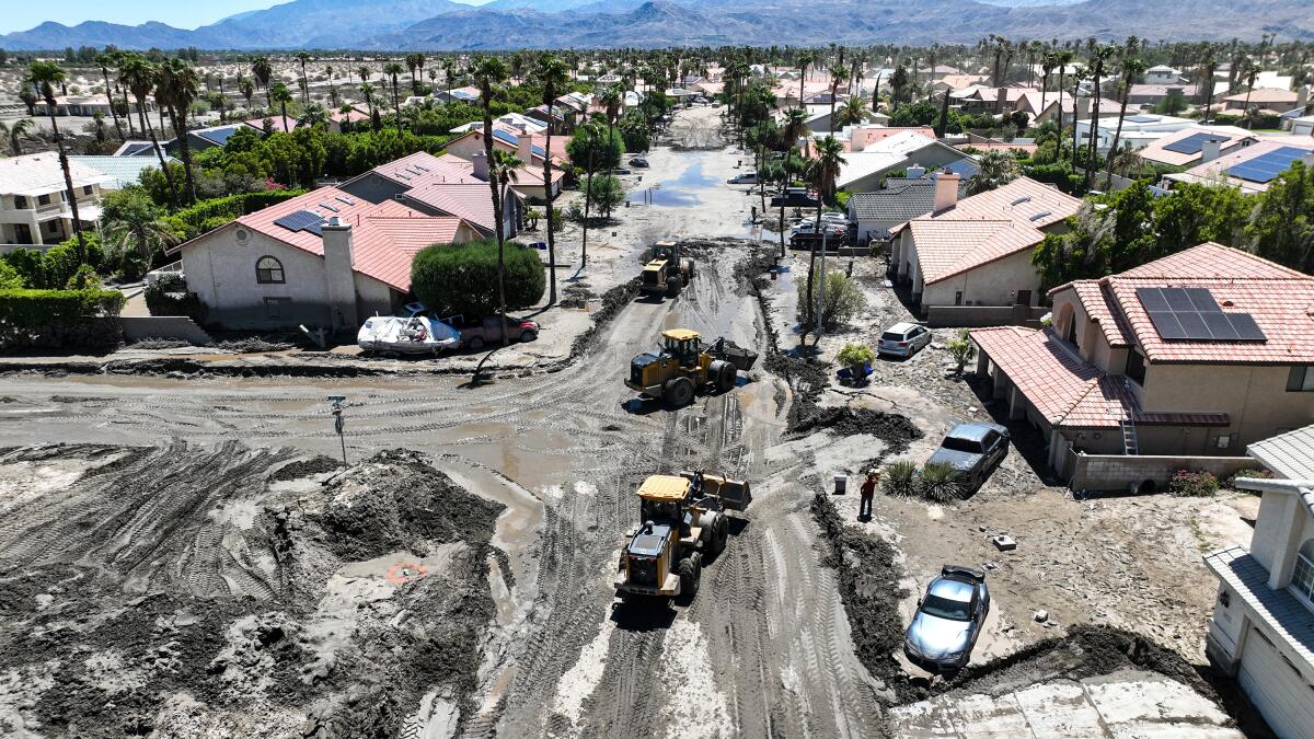
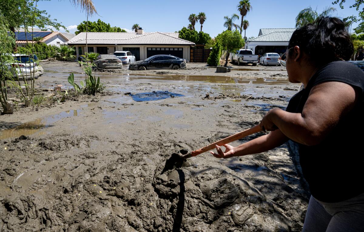
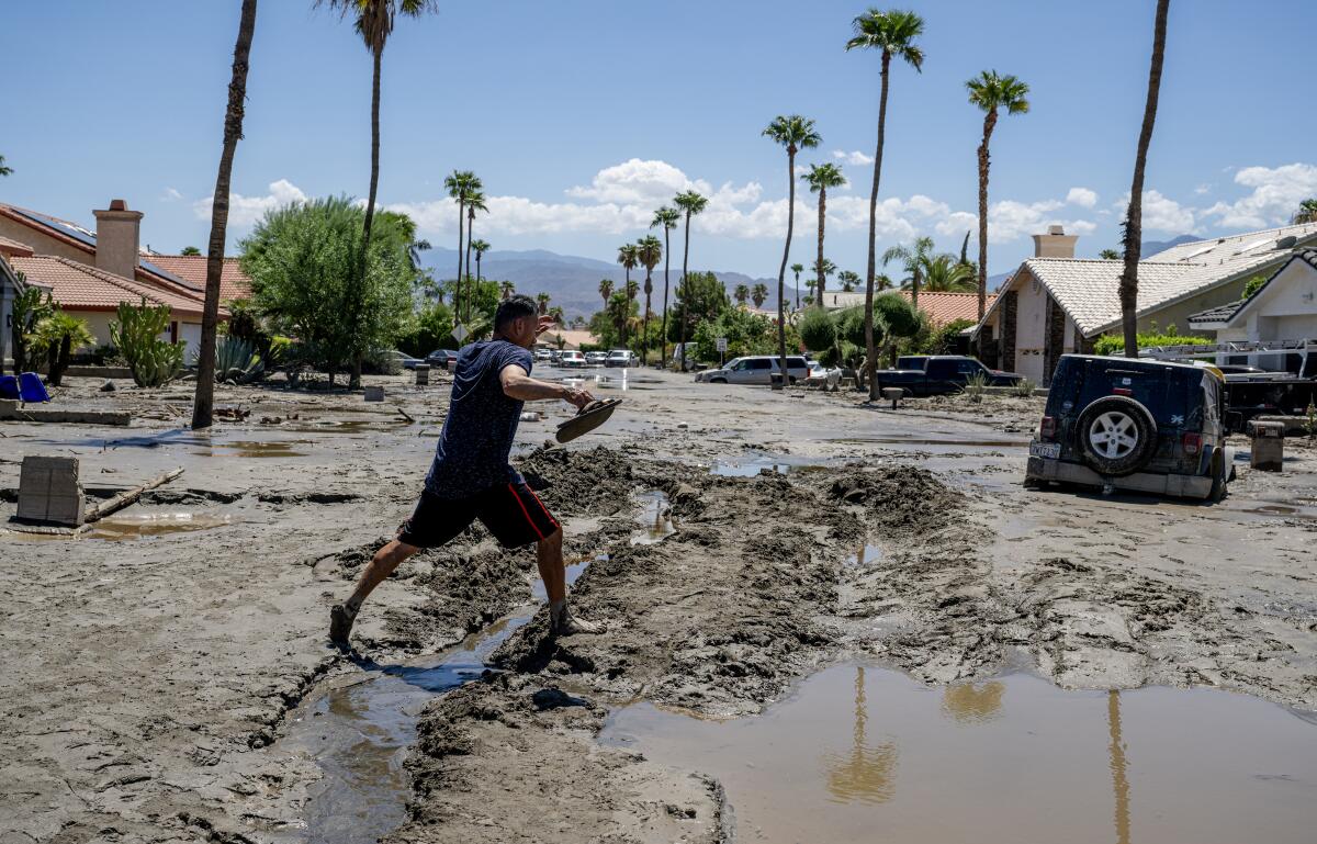
That’s not to say this storm didn’t do damage. Interior pockets of Southern California saw the heaviest rainfall, prompting dangerous slides and flooding in the mountains and deserts of San Bernardino and Riverside counties — with many communities still digging out days later. Although there haven’t yet been any official deaths attributed to the storm in the Golden State, at least one woman remains missing from a San Bernardino mountain town inundated by flash floods and debris flows.
But for much of the San Diego and Los Angeles metro areas, the catastrophic flooding that many braced for simply never came — though there was still significant precipitation, power outages and localized flooding.
After days of urgent warnings, Tropical Storm Hilary made landfall in Baja California on Sunday, turning roads into rivers and imperiling homes before barreling north toward Southern California.
Forecasters said Hilary’s rainfall across the region “obliterated” daily historical records, and in some cases the rainfall also pushed well past monthly records, according to the National Weather Service. Most of those new monthly records broke prior highs set in 1977, when the remnants of Hurricane Doreen hovered just off the Southern California coast — not reaching land at tropical storm speeds, but still dropping a ton of moisture inland.
A number of tropical depressions or other cyclone remnants have blown over and near Southern California in recent decades, leaving behind paths of wreckage, including Kathleen in 1976, which caused multiple deaths and damage across the Imperial Valley; and Norman in 1978, which tossed around ships in harbors and killed four on Mt. Whitney, according to a National Weather Service document.
Gonsalves noted that despite Hilary’s heavy precipitation, most areas did not set new monthly rainfall records — including San Diego, Riverside, Idyllwild and even Palm Springs — leaving highs still unsurpassed from 1977, when remnants of Doreen blew through, or even 1984 records, when there wasn’t a specific tropical storm but probably just a strong plume of tropical moisture that made its way north.
Areas that did set new monthly records after Hilary include Newport Beach, which reached 2.55 inches, well past the August 1977 record of 1.82 inches; Victorville in San Bernardino County at 2.63 inches, more than an inch over its prior record of 1.43 inches in 1977; and Camarillo’s airport at 2.59 inches, more than double its record from 1977. August monthly records were also shattered in downtown L.A., Long Beach and at UCLA, National Weather Service data show.
Despite winds reaching tropical storm strength, Schoenfeld said this storm didn’t touch Southern California wind records.
The most unusual part of Hurricane-turned-Tropical Storm Hilary was its path, forecasters said, which moved so quickly and directly north to southwestern California.
“They usually head more toward Hawaii,” Schoenfeld said, pointing to the track of Hurricane Kay last fall, which diverted west once it hit cooler waters — but still brought significant rainfall to Southern California.
For such storms to make landfall over California, Rhome said, certain weather conditions must align to pull them north — as happened with the high pressure system over the central U.S., which had a strong southerly flow that helped spin Hilary north, and fast.
“These systems, they tend to wind down slowly as they move north because they’ve lost their energy, but because this one was moving so quick it was able to just hang on that momentum just long enough to carry it into Southern California,” Rhome said.
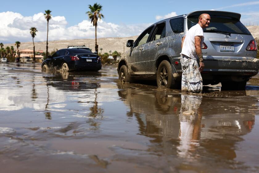
Tropical Storm Hilary left most of Southern California relatively unscathed. But Coachella Valley residents must deal with messy aftermath.
That speed helped minimize the destruction of the rainfall, officials said, because it didn’t linger too long over one area — as did the timing of the storm.
“We didn’t have commuter traffic that we might normally see,” said Shane Reichardt, spokesman for the Riverside County Emergency Management Department. “It also helped that the brunt of the storm happened in the evening and overnight hours. So all those factors together combined to help make that a little bit easier.”
While some have wondered whether the storm was overhyped, weather experts have pointed to the increased awareness and likely appropriate alarms — especially given the destruction that did occur in many parts of southeastern California.
“Ideally if people take precautions and mitigation is done ahead of time, you would have fewer impacts and less bad things would happen — which is a good thing,” Iñiguez said. “The system worked.”
Times staff writers Rachel Uranga and Rong-Gong Lin II contributed to this report.
More to Read
Sign up for Essential California
The most important California stories and recommendations in your inbox every morning.
You may occasionally receive promotional content from the Los Angeles Times.
