Coldest storm of the year brings rain, thunder and snow to Southern California

- Share via
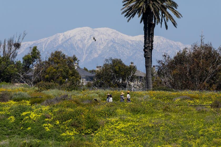
A cold Pacific storm blasted Southern California on Friday with winter-like temperatures, high winds, hail and what appeared to be the lowest-elevation snow so far this year, posing a risk for drivers on several mountain roads.
There was a chance for snow at elevations as low as 2,000 feet in the Los Angeles, San Bernardino, Riverside and San Diego county mountains — the lowest freezing point seen this year, said Rich Thompson, a National Weather Service meteorologist in Oxnard.
“For this winter season, this definitely is the coldest,” Thompson said. It is not a particularly moist system, however, which means snow totals — at least in Southern California — are expected to remain in the inches, with only a dusting expected at the lowest elevations.
Forecasters on Friday confirmed there had been snow flurries in Lancaster at 2,300 feet in elevation, as well as at about 3,000 feet in Warner Springs in San Diego County, with the chance for more snow through at least 11 p.m.
“It’s not going to be a ton, but even a little bit on those mountain pass roads — [Highway] 14, the Grapevine — just a little bit of snow can cause issues for people,” Thompson said.
Heavy snow and high winds on Friday night prompted the California Department of Transportation and California Highway Patrol to temporarily halt traffic through the Grapevine, a stretch of the 5 Freeway between Bakersfield and Santa Clarita. The roadway was reopened with CHP escorting traffic as of 10:35 p.m., according to CalTrans.
Officials expected highs to remain below 60 across much of the region, with records set at several locations.
“This is a cold storm for Southern California regardless of the time of year, but especially for early April,” said Jon Suk, a National Weather Service meteorologist in San Diego.
But warmth is on the horizon, with temperatures expected to reach the mid- to upper 70s by Tuesday.
Here’s what you need to know:
What is the schedule?
The storm made its way south across California on Friday after hitting northern parts of the state with rain, low-elevation snow, and some hail Thursday.
Temperatures began to fall statewide, including across the Southland on Thursday, but Friday was expected to be even colder, said Mike Wofford, a National Weather Service meteorologist in Oxnard.
Where can you expect to see storm effects?
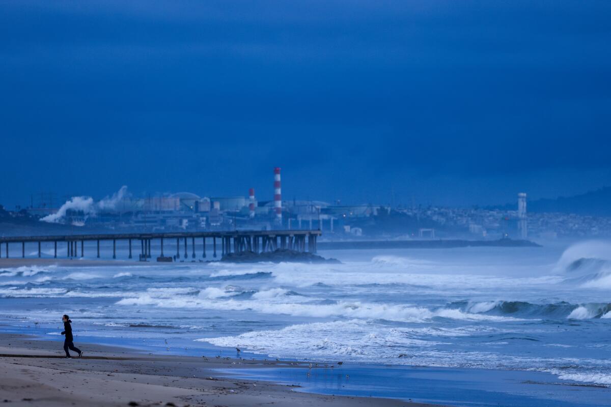
Pretty much all of California has seen cold, wet, unsettled weather from this storm — from snow in the mountains to dangerous surf along the coast.
In the Los Angeles, Riverside and San Bernardino County mountains — including across the 5 Freeway and Highway 14 corridors — a winter weather advisory is in effect until late Friday.
“Travel could be very difficult to impossible,” the warning said.
Snow started to fall late Thursday in some areas across the Sierra Nevada, while flurries and minor accumulation picked up Friday in some parts of the L.A. and San Bernardino County mountains.
Reports Friday afternoon showed 2 inches of snow in Lake Arrowhead, an inch in Crestline and 4 inches at Palomar Mountain. Snow fell but did not stick around 2,500 feet above sea level, including in Palmdale, Lancaster and the Antelope Valley, according to the weather service. But above 3,000 feet, the snow was sticking.
Transportation officials sent out alerts that chains would be required for most Southern California mountain roads Friday.
Temperatures on Thursday are expected to drop 20 degrees in some areas from Wednesday’s highs as a cold storm blows across California. Some regions could feel historic low temperatures.
Snow was expected to continue Friday night across the Sierra Nevada, with up to a foot of snow and 60-mph winds expected at elevations above 3,000 feet, according to the Weather Service.
What’s coming?
The storm’s most notable feature remains its cold, Wofford said, which is driving that low-elevation snow.
“Max temps today will end up only in the mid to upper 50s, or 10 to 20 degrees [below] normal,” the National Weather Service’s Friday update said. “Today’s max temps would be below normal even if it were January.”
Above 5,000 feet, snowfall totals are expected to be between 3 and 10 inches.
Up to a foot of snow is possible on the San Bernardino and Riverside County mountains’ highest peaks, with 2 to 4 inches of snow possible from 4,000 to 5,000 feet in elevation and snow showers likely from 3,000 to 3,500 feet — enough to accumulate along the Cajon Pass.
Meteorologists said snowfall would taper off overnight Friday, but there was a chance of additional snow showers around the Grapevine.
Rain totals weren’t expected to be too high, with about a half-inch predicted for most of L.A. County and an inch expected in the foothills and mountains.
From the Central Coast down to San Diego, there’s also a concern for high surf, with warnings of 8- to 16-foot waves and dangerous rip currents. This will remain an issue through Saturday.

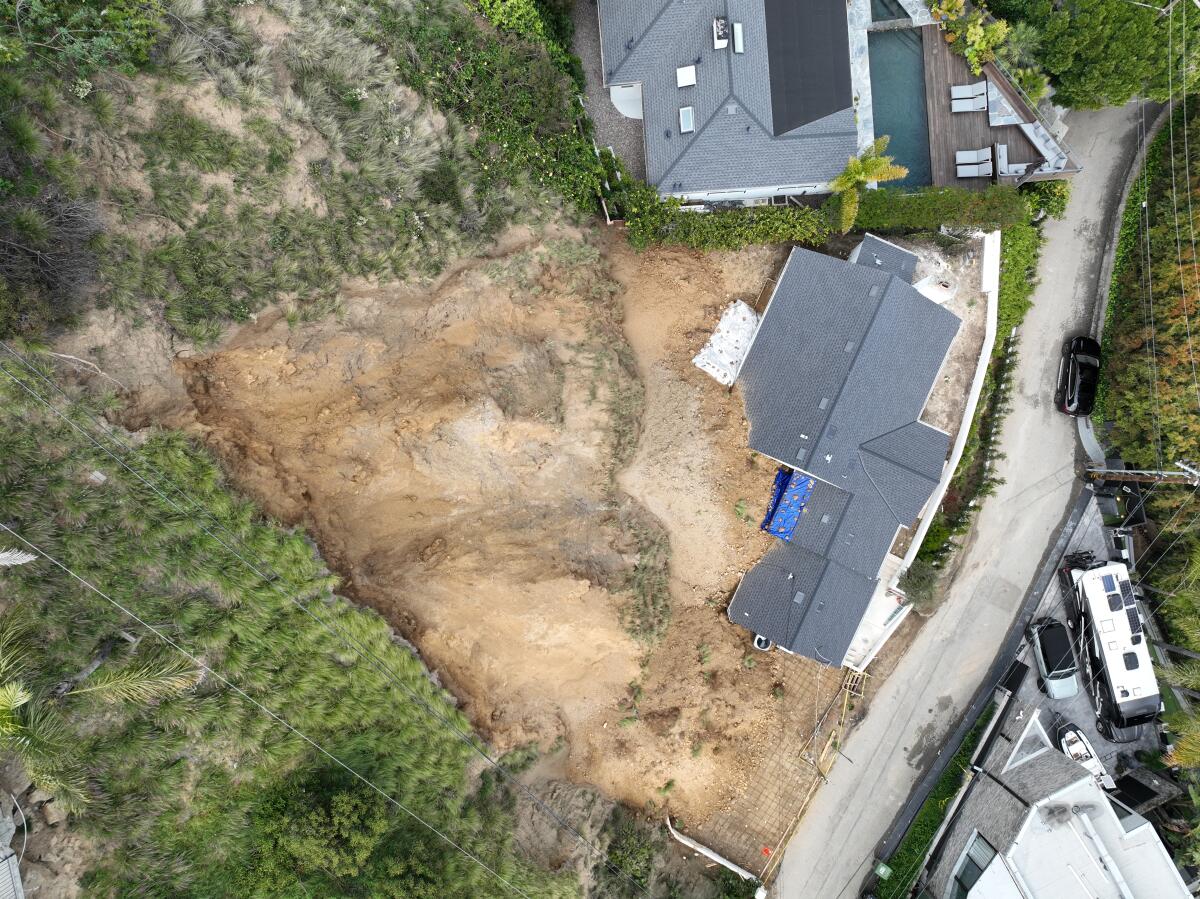
Officials are continuing to monitor a Newport Beach bluff that partially collapsed in a landslide early Thursday, forcing the evacuation of three homes; as well as major road damage on Highway 1 in Big Sur from a different slide last weekend, with concerns that further rain could exacerbate the situation. In the Hollywood Hills, a hillside collapsed on top of and into a home, causing significant damage.
Could this storm be record breaking?
Cold temperatures on Friday set some daily records, weather officials said.
Temperatures throughout Friday ranged from 7 to 20 degrees below normal, said Rose Schoenfeld, a meteorologist with the National Weather Service in Oxnard.
Anaheim, Big Bear, Palomar Mountain, Vista and Idyllwild all broke records for the lowest maximum temperature recorded on April 5.
The current historic record for the coldest April 5 in downtown L.A. is 55 degrees — but Friday’s high was 59, unusually brisk but only the seventh-coldest April 5 recorded by the National Weather Service.
At Los Angeles International Airport, Friday saw a high of 58, the coldest April 5 on record, just below the previous record of 59 degrees.
Palmdale also set a record for the coldest April 5: The city saw a high of 51 degrees, whereas the previous record was 53 degrees.
In the mountains, Big Bear set one record. Its coldest April 5 on record previously topped out at 35 degrees, and Friday only got as warm as 29 degrees. It also could hit a record low temperature for Friday or Saturday, if temperatures fall below 16 degrees, as forecast.
“It’s going to be close,” Wofford said.
As for rainfall, Wofford said it’s unlikely the region will hit any records, despite being close to the wettest two-year period in history. Downtown L.A. is less than two inches away from hitting that record — and could do so anytime before the end of September — but this storm isn’t expected to push the total over the edge.
The wettest back-to-back water years on record occurred in the late 1800s and saw 54.1 combined inches of rain. Currently, downtown L.A. is at 52.46 inches since Oct. 1, 2022. (Water years run October through September.)
“It’s not likely we’ll do it with this storm, but it’s not impossible,” Wofford said.
How long will it last?
Forecasts show this storm should clear out by Saturday, with some dry and warmer weather on the way.
“It’s a quick-hitter so we don’t see the impact over the weekend,” said Alex Tardy, a meteorologist with the National Weather Service in San Diego. “In fact, the snow will taper off Friday night ... and we warm up pretty quick.”
He said by Saturday afternoon, much of Southern California’s coasts and valleys will be back to temperatures in the mid-60s — only slightly below average for this time of year.
“We are going to pick up a little temperature Saturday and warming by 4 to 10 degrees regionwide,” said Schoenfeld, with similar temperatures on Sunday. “After that, we’re going to head into a pretty good warming trend.”
That trend is expected to continue during the week, with temperatures Wednesday and Thursday forecast into the 80s, with clear and sunny skies.
More to Read
Sign up for Essential California
The most important California stories and recommendations in your inbox every morning.
You may occasionally receive promotional content from the Los Angeles Times.


