Anatomy of a monster: Maui fire seemed under control. Then it exploded with lethal force
- Share via
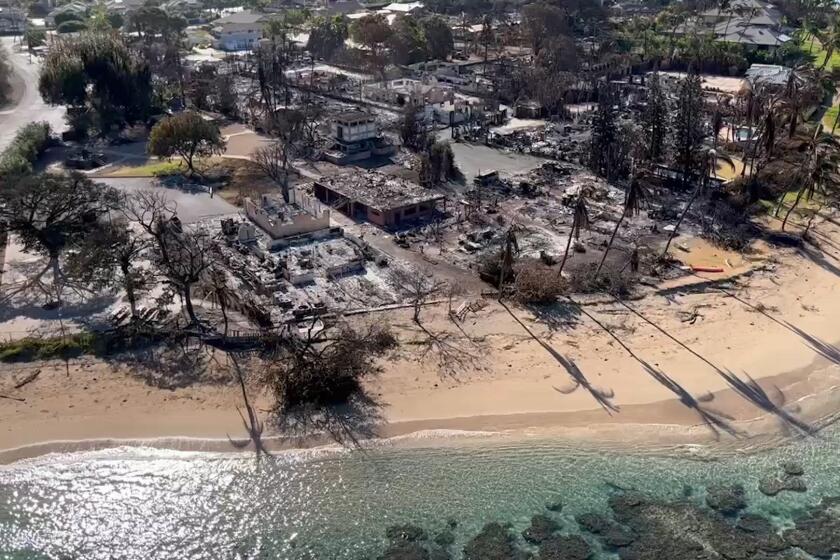
Despite the horrific images of a community leveled by fire, the true scope of the Maui fire — the worst natural disaster in Hawaii in decades — has yet to come into full focus.
The official death count stands at 89. And officials expect it to rise. The Maui fires are now the deadliest in the U.S. in the last century, surpassing the 2018 Camp fire that destroyed the Northern California town of Paradise, killing 85.
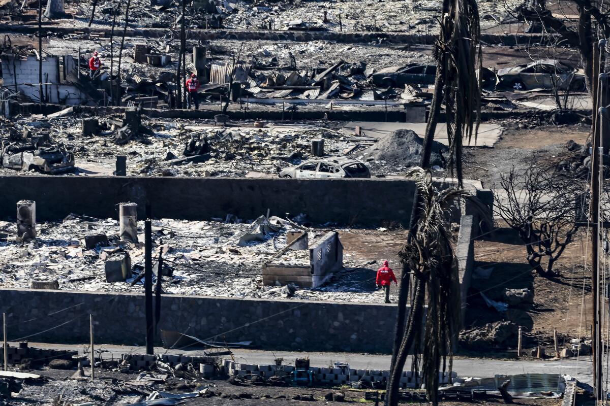
Authorities have yet to search for victims inside buildings. About 1,000 people are missing, according to federal sources who were not authorized to speak publicly about the fires.
One woman said even the ocean could not save those fleeing the flames.
“They jumped in the ocean to escape that but then there were still people dying of smoke inhalation in the ocean,” said Brittany Harris, 37. “My friend, whose husband is a police officer, said there are bodies everywhere, there are bodies in trees.”
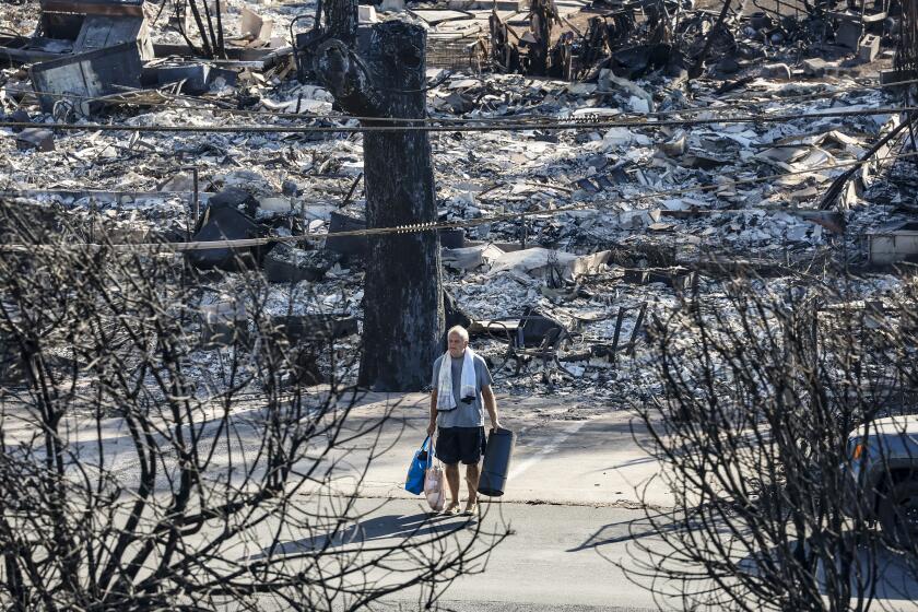
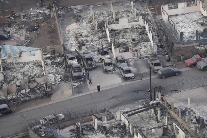
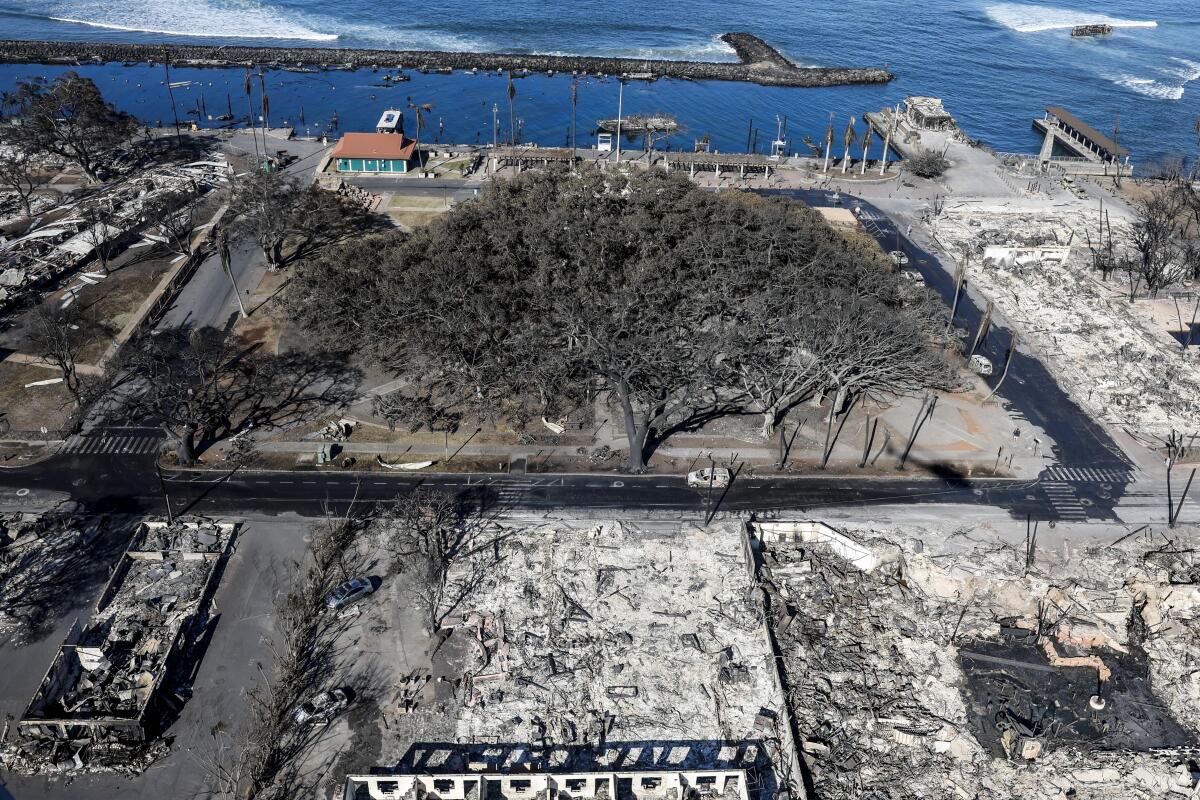
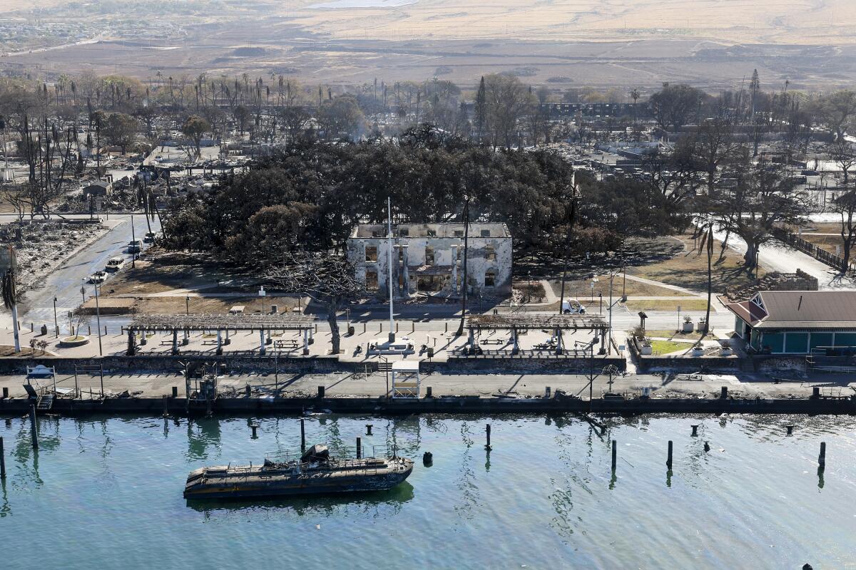
Officials estimated that as many as 2,200 buildings have been destroyed in the fires, hundreds of them in Lahaina. Even some of the vessels in Lahaina Harbor were burned.
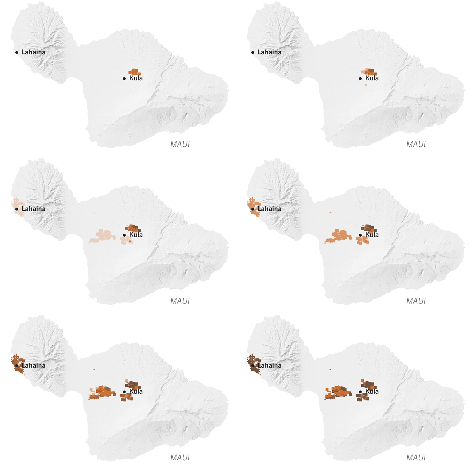
The Lahaina fire in West Maui ignited as firefighters focused on the Upcountry fire. What happened next — the deadliest U.S. wildfire in more than a century — left the historic town in ashes.
So how did the fire become such a disaster, leveling whole blocks of a historic city and destroying so many lives?
Here is what we know about the origin of the fire and how it so rapidly became an unstoppable force.
Early confidence
Bulletins posted on Maui County’s Facebook page indicate that the first report of a brush fire in Lahaina came in at 6:37 a.m. Tuesday, and evacuations were ordered within three minutes around Lahaina Intermediate School on the town’s northeastern edge, at its highest elevations.
The blaze hit as fire crews were battling another wildfire farther east.
But the sense of alarm seemed to fade by around 10 a.m., when Maui County said it had declared the Lahaina brush fire “100% contained,” although it did warn of power outages limiting the ability to pump water and a report of a downed electric line in the area.
Disastrous turn
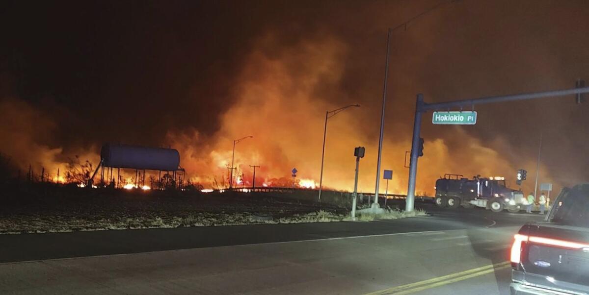
The Lahaina fire then flared up in the afternoon. Maui County said around 3:30 p.m. that the fire forced the closure of the Lahaina Bypass, a major road near the intermediate school also known as Highway 3000.
The message on Facebook said evacuations were occurring in that area.
Hawaii Gov. Josh Green says the fires are probably the state’s deadliest natural disaster in decades.
The blaze began burning homes in that upper area, Maui County Fire Chief Brad Ventura said. It then moved downhill, southwest toward the coast, following prevailing winds and toward the Kahoma neighborhood.
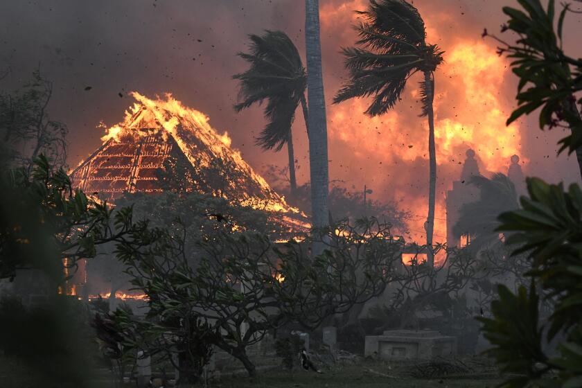
It was around 3:30 p.m. that Dustin Kaleiopu said he noticed the smoke started to get thicker and make its way closer to his home, which was without power and communication, he told NBC’s “Today” show. Then, he heard an explosion from a nearby gas station. “By 4:30, our neighbor’s yard was on fire, and we had minutes to escape,” Kaleiopu said.
As homes were burning, the only two exit routes out of Lahaina were closed or jammed. The route up to the north — a narrow road that is a one-lane highway in many places — was closed Tuesday afternoon. And at certain points around the same time, so was the main exit south out of town, where roads were blocked by fallen power poles, according to a review of Facebook posts by county officials.
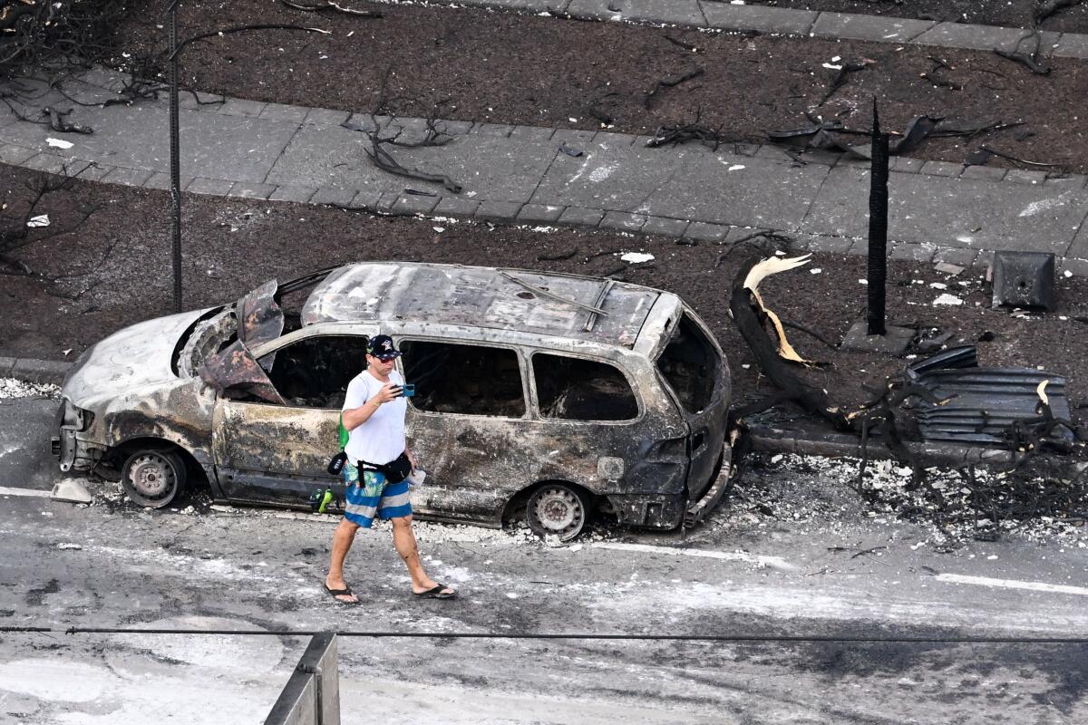
Eventually, virtually all of central Lahaina was reduced to ash.
After nightfall, conditions had deteriorated so much that Maui County urged all West Maui residents to shelter in place unless they were “in an impacted area.”
Dangerous conditions
Experts said winds, drought and ground conditions all played roles in the disaster. Climate change could be one contributing factor, with hotter weather drying out vegetation, which can then fuel brush fires.
The spread of highly flammable, nonnative grasses — left after property owners abandoned sugar cane or pineapple farms and ranches — has long been a concern. Nonnative grasses were brought to Hawaii to feed cattle when people of European ancestry arrived on the islands. But as farms and ranches shut down in recent decades because they were no longer as profitable, the flammable brush has been spreading throughout Hawaii, raising the risk of catastrophic wildfire.
Wildfires on the Hawaiian island of Maui have killed at least 36 people, displaced thousands of residents and destroyed hundreds of structures, including homes, businesses and a school, prompting President Biden to declare a “major disaster.”
Meteorologists had also issued warnings about the dangerous weather conditions in place on Tuesday. With high pressure to the northeast and low pressure from Hurricane Dora far to the southwest — and because wind flows from areas of high to low pressure — Lahaina was arguably in the worst possible situation once a fire ignited, the target of swift winds that roared from the canyons above town right into residential subdivisions and then into the historic waterfront, leaving the ocean as the only exit path for many.
Chaotic evacuations
Many residents have said they did not get warnings to evacuate, though others said they did.
A communications breakdown left many to run for their lives, and some could not escape the flames.
Records indicate that neither the state nor the county activated sirens Tuesday, said Adam Weintraub, a spokesperson for the Hawaii Emergency Management Agency. Weintraub described Hawaii’s integrated outdoor siren system as the largest in the world, with about 400 sirens spread across the state. It is traditionally used in disasters and other threats, such as hurricanes or coastal hazards, to advise people to seek more information — not to call for evacuations or advise that people seek shelter — Weintraub said.
The Hawaiian Islands do see wildfire from time to time, but the catastrophic Maui fires were spawned by a striking mix of factors, including climate change.
Three other public warning systems were used, Weintraub said: wireless emergency alerts to cellphones, broadcasts through radio and television stations and alerts that residents can sign up to receive through a local emergency alert system. But, with the power out and communications systems down, many residents reported receiving no alerts.
Federal sources with knowledge of the fires but who were not authorized to speak publicly told The Times that a breakdown in emergency communications cost precious time, and a number of people in the historic town of Lahaina learned too late about the oncoming fire. Many of those killed were believed to have died in their vehicles, those sources said. Many of the deaths counted thus far are from the most urbanized areas, with some bodies recovered from the harbor, they said.
Multiple red flags
The potential for high fire danger was well anticipated by the National Weather Service. Four days before multiple wildfires broke out Tuesday, the weather service in Honolulu warned of “high fire danger”; two days before the fire, the agency published an animation showing how damaging winds and fire weather were expected Monday through Wednesday.
A Maui tourist hub looks like a wasteland, with homes and entire blocks reduced to ashes in one of the deadliest U.S. blazes in recent years.
Lahaina was in the direct line of downslope winds moving from the northeast to the southwest. As the air is forced to descend down the mountain slope, it increases speed, warms up, and dries out further, and “you get that trifecta of hot, dry and windy and downslope winds,” said UC Merced climatologist John Abatzoglou.
Maui County’s 1,044-page hazard mitigation plan lists coastal West Maui as having a high wildfire risk. A map on Page 503 shows all of Lahaina’s buildings as being in a wildfire risk area, and the document warns that “populations with limited access to information may not receive time-critical warning information to enable them to reach places of safety.”
More to Read
Sign up for Essential California
The most important California stories and recommendations in your inbox every morning.
You may occasionally receive promotional content from the Los Angeles Times.
