Santa Ana winds are sweeping the region
- Share via
Powerful Santa Ana winds began to sweep across Southern California late Saturday, with gusts of up to 80 mph expected in places as extremely blustery weather continues through Tuesday afternoon, increasing road and fire hazards.
The strongest winds are expected in eastern Ventura and western Los Angeles counties below canyon passes, meteorologists said, but gusts in the L.A. Basin could reach up to 65 mph as early as this morning.
The National Weather Service issued a red flag fire hazard warning for Los Angeles and Ventura counties for late Saturday through Tuesday. The Los Angeles Fire Department also announced red flag parking restrictions that will take effect at 8 a.m. today on winding roads in the Hollywood Hills and other fire-prone areas.
The fire risk is especially great because it’s been a record dry period for the Southland, with downtown Los Angeles, Long Beach and other areas receiving just a fraction of their average annual rainfall.
“Conditions are ripe for what we call extreme fire behavior. If a fire were to develop, even a downed power line can have this arcing and that can be with sparks and can cause a fire and spread pretty quickly,” said Joe Sirard, a meteorologist with the National Weather Service in Oxnard.
Already Saturday night, officials reported numerous downed power lines and outages across the basin, from Century City to Bel-Air and North Hills.
At least 1,400 people were waiting to have power restored Saturday night, according to Mary Anne Pierson, a spokeswoman for the Los Angeles Department of Water and Power. Pierson said crews were removing fallen tree limbs, repairing lines and making sure the arcing of downed lines hadn’t ignited any fires.
No major fires were reported in the L.A. area Saturday. In Santa Barbara, winds drove dust and ash down from the mountains into town, remnants of the Zaca Fire this summer.
During the next few days, winds will be strongest from morning to early afternoon, Sirard said, driven by a high-pressure front moving south through the mountains that is expected to weaken in the afternoons, when temperatures will climb into the 80s and 90s as humidity drops across much of the L.A. Basin.
Fire officials said they will be keeping an eye on the San Fernando Valley and the foothills of the Santa Monica range, where homes adjoin brush. They cautioned those who plan to camp or cook outdoors during the windy weather to check local fire restrictions first.
“Any time you go out into a wooded area on a high-risk fire day, you have to be very careful,” said Ron Myers, a spokesman for the Los Angeles Fire Department, noting that small blazes under such hazardous conditions endanger not only those who set them, but also “individuals who are risking their lives to fight these fires and other individuals who are at risk of losing their homes.”
Myers said residents should also check parking restrictions in their neighborhoods and areas they plan to visit.
“All it takes is one vehicle blocking a turn and one of our engine companies being unable to make a corner to prevent us from reaching an area to protect those structures” from a fire, he said.
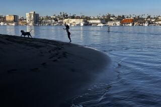
Though beaches are expected to be open today, lifeguards cautioned that visitors should be aware of the wind at their backs as they kayak, windsurf or kite surf out to sea, because the same wind could stop them cold when they try to return to shore.
“It’s great when you’re going offshore, but when you try to turn around to come back, you’re stuck,” said Jim Makuta, a captain with L.A. County Fire Department’s lifeguard division, adding that lifeguards have had to rescue kayakers under similar conditions in the past. “Even if you’re in a flat plane area, the wind can come up, and even if you’re pretty strong, you can’t get back.”
Highway officials cautioned that winds will probably stir up dust and reduce visibility on area highways, particularly in the high desert north of Los Angeles, where winds were already picking up late Saturday.
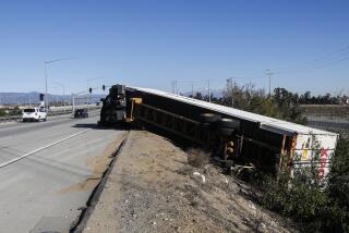
Winds of more than 55 mph may have contributed to a three-vehicle crash that injured three people and blocked southbound lanes of the Golden State Freeway near the Grapevine for half an hour starting about 3 p.m., said Officer Patrick Kimball of the California Highway Patrol.
About the same time, the northbound 14 Freeway was closed at Avenue D north of Lancaster, and southbound lanes at Avenue A, as winds of 45 mph were reported filling the air with dust and reducing visibility to zero. Earlier this week, two motorists died in crashes on the same stretch of road while trying to drive through the dust and wind.
Officials said that those traveling in tractor trailers, camper trucks and even SUVs over the next three days should be especially wary of winds whipping across highways as they drive westward or through the Cajon Pass and other treacherous mountain roads.
“As the visibility starts to narrow, reduce your speed. And if you have no visibility, pull over,” said Kimball, calling the wind forecast and freeway closures “quite significant” even in a desert town accustomed to extreme gusts.
Some locals were already concerned about the forecast Saturday night. At Diamond Jim’s Casino in Rosamond, the regular crowd had thinned from 150 to 80, with many customers at home, “scared about driving against the wind,” floor manager Panu Sewanjinda said.
“Almost every year it happens, but in the 13 years I’ve been here, I’ve only seen it this way two or three times,” he said of the Santa Ana winds. “Now you walk outside and you can’t stand up.”
Others, such as bartender Ryan Ibbotson, 32, of Quartz Hill, accustomed to extreme weather, were still waiting to be wowed by the gusts.
“The wind blows so much here,” Ibbotson said, “we’re beyond wind stories.”
For more information on red flag parking restrictions, call 311 or visit www.lafd.org/redflag.
--
molly.hennessy-fiske @latimes.com
Staff writer Jason Felch contributed to this report.
More to Read
Sign up for Essential California
The most important California stories and recommendations in your inbox every morning.
You may occasionally receive promotional content from the Los Angeles Times.


