Major storm caps California’s wet season with more rain, winds, snow
- Share via
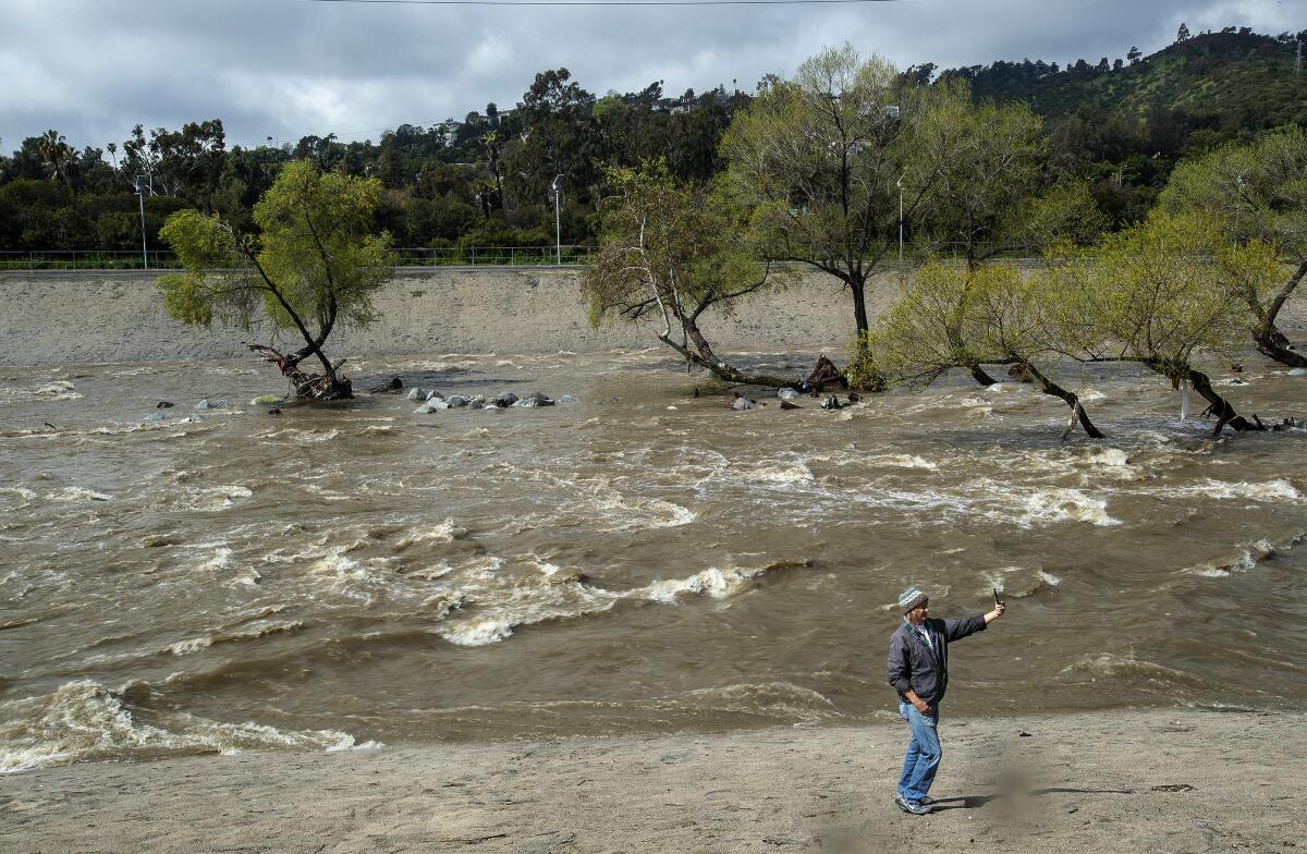
More rain, wind and mountain snow pelted California on Wednesday as a cold storm swirled over the soaked state, capping a soggy March and one of the most prodigious wet seasons in recent memory.
The massive low-pressure system churning over the Pacific generated dozens of wind advisories and winter storm warnings across the state, with forecasters warning of blustery conditions and even more snow atop what is already a record snowpack. Severe weather — including damaging winds, lightning, hail and a potential waterspout or tornado — is possible in the Los Angeles area through early Thursday.
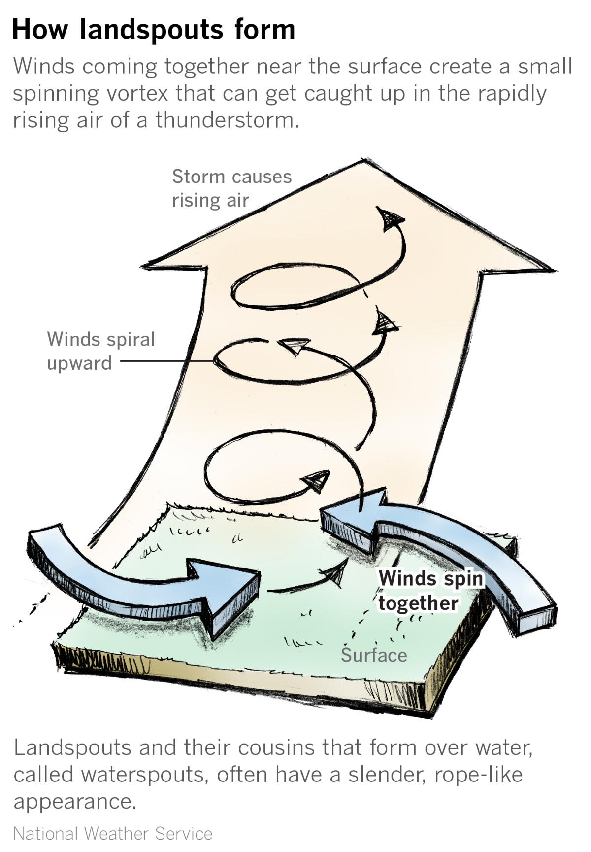
The National Weather Service warned that the incoming pattern was similar to a storm last week that produced tornadoes in Carpinteria and Montebello, with the highest risk of severe weather over coastal areas of San Luis Obispo, Santa Barbara, Ventura and L.A. counties.
“While there is a risk of small tornadoes, the chance of a tornado hitting any one particular location is extremely small,” the agency said. “If severe weather occurs, people should seek shelter indoors, in the most interior room, away from windows.”
Dangerous conditions were also reported on the roads as a portion of Interstate 5 near Castaic collapsed due to a landslide, prompting lane closures, according to the California Department of Transportation.
The slope is “starting to slide away from the side of the freeway” and will need to be repaired when conditions are safer, said spokesman Marc Bischoff. He did not have an estimated time for when the lanes would reopen.
Gov. Gavin Newsom on Tuesday expanded his storm state of emergency declaration to 43 counties and requested a presidential disaster declaration for the counties of Calaveras, Kern, Los Angeles, Mariposa, Monterey, San Benito, Santa Cruz, Tulare and Tuolumne. If approved, the declaration could boost emergency response and recovery efforts in communities affected by storm-related flooding, debris flows, snow and avalanches.
“Over these past months, state, local and federal partners have worked around the clock to protect our communities from devastating storms that have ravaged every part of our state,” Newsom said. “We will continue to deploy every tool we have to help Californians rebuild and recover from these storms.”
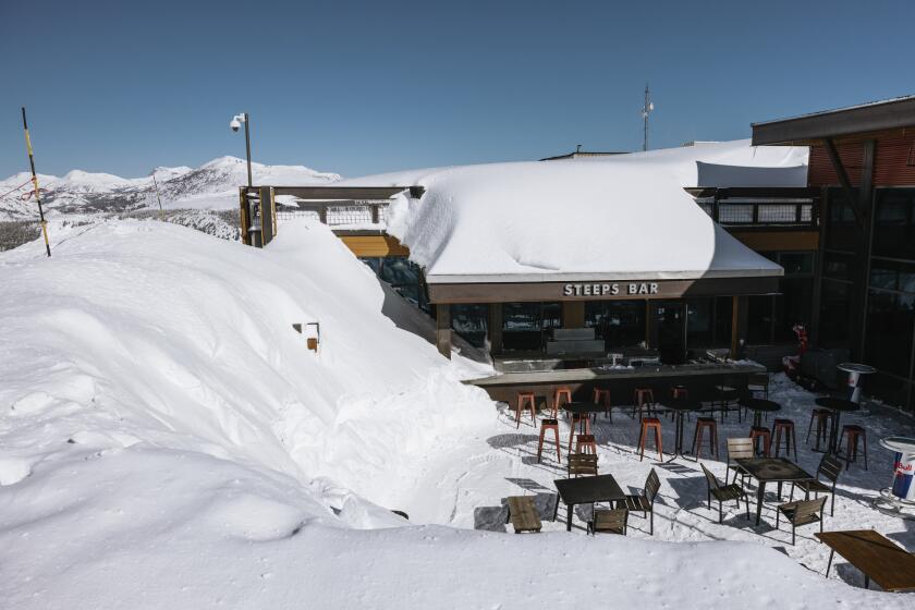
This season’s snowfall beats the record by nearly 30 inches, with possibly more to come. ‘We’ll be open daily through at least July,’ the resort said.
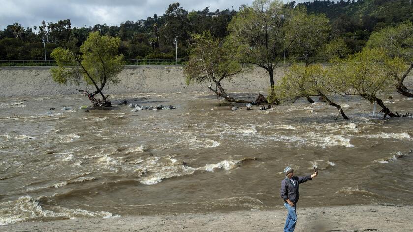
Almost no corner of California has gone untouched by this year’s wet season, which typically runs from late fall to the end of March. The season was marked by deadly atmopheric river storms, fatal blizzards and devastating flooding that left thousands stranded and some communities underwater.
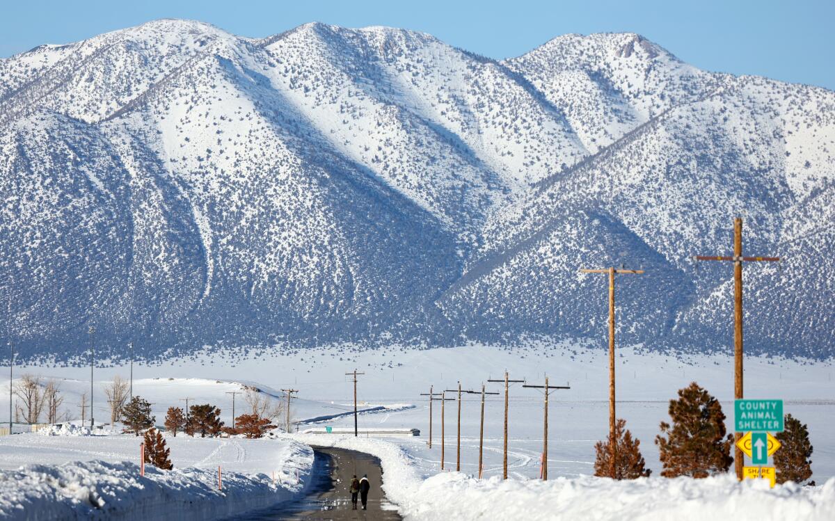
The season also saw extraordinary snowfall, with Mammoth Mountain on Wednesday reporting that it has received a season total of 695 inches, more than in any other year on record at the resort.
Moisture was so plentiful this year that Los Angeles received more rain than Seattle, according to data from the weather service. Los Angeles International Airport has recorded 16.97 inches of rainfall since Jan. 1 — more than twice the normal amount of 7.5 inches and nearing the record of 20.33 inches set in 1978. Seattle-Tacoma Airport has seen 7.61 inches this year.
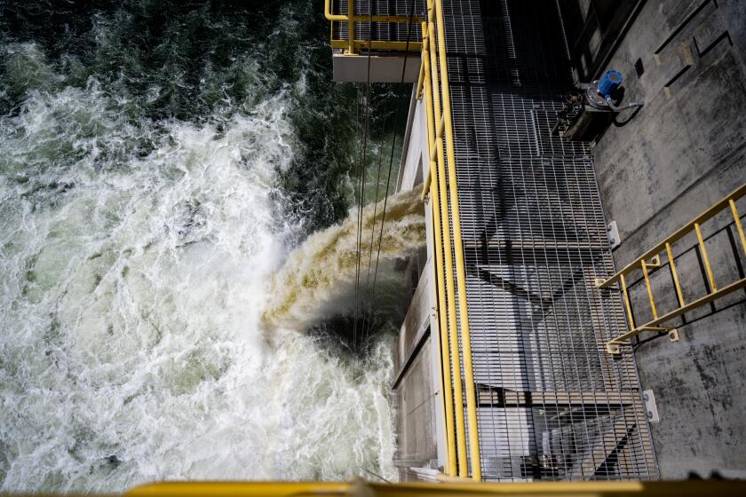
Though the storms caused chaos and destruction, they also significantly eased drought conditions in the state after three years of record dryness. Once-depleted reservoirs are now healthy and full, and Newsom last week lifted much of the statewide drought emergency declaration he issued in 2021.
State and federal officials were also able to dramatically increase allocations for water suppliers that received only scant supplies last year.
The State Water Project upped its allocation for urban water agencies serving 27 million people from 35% to 75%, and the U.S. Bureau of Reclamation said this week it was increasing Central Valley Project allocations for many irrigation districts and municipal and industrial contractors to 80% — in some cases as much as 100%.
Diamond Valley Lake — a backbone of the region’s water storage system — should refill to its full capacity by the end of this year, officials said.
And more wet weather is on the way. The latest system caused some power outages and downed trees in Northern and Central California on Tuesday, when San Francisco tied its record for the lowest maximum temperature for the day at 52 degrees. But the storm is generally expected to be weaker than the “bomb cyclone” and atmospheric rivers that came before it.
However, there is a risk of even more Sierra snowpack and excessive rainfall along the coast, which could lead to localized flooding given the already very wet conditions, the weather service said.
Satellite imagery showed the center of the storm off Northern California on Wednesday. The system was expected to move slowly southward throughout the day before tracking inland across Southern California as it weakens early Thursday.
In the Los Angeles area, rain was expected to continue on and off throughout the day. A brief pause in the afternoon was expected to give way to a stronger surge of moisture from the same storm system Wednesday night into Thursday, including the potential for damaging and dangerous weather.
Newsom’s decision to rescind some of the most severe restrictions comes after drenching storms eased extreme drought conditions across the state.
Coastal areas and valleys from San Luis Obispo to Los Angeles could get up to an inch of rain, while foothills and mountain areas could see up to 3 inches. Rain rates of up to a quarter of an inch per hour are expected, with isolated instances of half an inch per hour.
The storm will also deliver snow, up to 8 inches at elevations above 5,000 feet. The mountains of Santa Barbara and Ventura counties could get up to 14 inches, with 18 inches possible in the L.A. County mountains.
A winter storm warning was in effect until 2 p.m. Thursday in the eastern San Gabriel Mountains, including Mt. Wilson, Mt. Baldy, Wrightwood and the Angeles Crest Highway. Heavy snow is expected with winds gusting as high as 45 mph.
A winter weather advisory is also in effect until 2 p.m. Thursday in the western San Gabriel Mountains and Highway 14 corridor, including Acton, Warm Springs and Mill Creek, where up to 12 inches of snow is possible on higher peaks.
The conditions could spell trouble for areas including several San Bernardino County mountain communities that only recently dug out from a blizzard earlier this month.
The weather service has issued a winter storm warning in the San Bernardino Mountains until 2 p.m. Thursday, advising of “difficult to impossible” travel conditions, 65 mph wind gusts and up to 10 inches of snow above 5,000 feet. Up to 18 inches is possible on higher peaks.
“If you must travel, take an extra flashlight, food, water, in case of an emergency, and before you leave, check the latest road conditions,” said James Brotherton, a meteorologist with the weather service in San Diego, which covers the San Bernardino Mountains.
Brotherton said the Cajon Pass would also see snow Wednesday evening through Thursday morning.
“People driving from L.A. to Las Vegas and not realizing they’re going over a mountain range and there happens to be snow — that’s probably the biggest impact,” he said. “People that aren’t prepared for those conditions.”
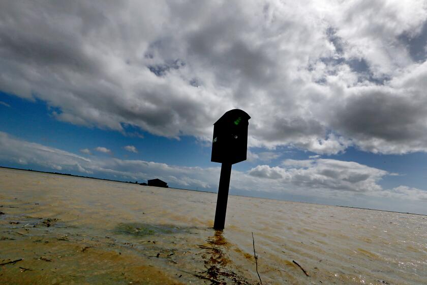
As historic storms fill once-dry Tulare Lake and submerge prime California farmland, tensions are building over how to handle the swiftly rising floodwaters.
Forecasters are also keeping a close eye on the Central Valley, where winter storm warnings and flood watches were in effect for the Sierra Nevada and nearby areas spanning from Bakersfield to Yosemite. Heavy snow and strong winds are possible at high elevations, with excessive runoff threatening to flood rivers, creeks and streams in lower-lying areas.
Thousands of residents in Tulare County remained under evacuation warnings, including the areas of Porterville and Allensworth, which have endured devastating flooding as this year’s storms swelled rivers, melted snow, breached dozens of levees and spurred the reemergence of the once-dry Tulare Lake.
- Share via
A massive low-pressure system swirling over the Pacific has generated dozens of wind advisories and winter storm warnings for California.
Showers, thunderstorms and the threat of heavy precipitation and more flooding are forecast in the area Wednesday and into Thursday, forecasters said, noting that “soils have had little to no time to dry out from the previous events, creating ideal runoff conditions.”
Storm clouds in the Central Valley — and in most of the state — are expected to clear by Thursday afternoon. The weekend will bring drier weather to the storm-soaked state, but wet conditions are again on the horizon next week.
More to Read
Sign up for Essential California
The most important California stories and recommendations in your inbox every morning.
You may occasionally receive promotional content from the Los Angeles Times.
